Application Description
Zoom Earth provides a comprehensive platform for tracking hurricanes, typhoons, and tropical cyclones in real-time, ensuring users have the latest information at their fingertips. As an interactive weather map and hurricane tracker, it features a variety of tools that enhance the user experience and provide critical data.
Key Features
Satellite Imagery: Zoom Earth utilizes near real-time satellite imagery from renowned sources like NOAA GOES, JMA Himawari, EUMETSAT Meteosat, and NASA's Aqua and Terra polar-orbiting satellites. This enables users to view detailed weather patterns and storm developments as they happen.
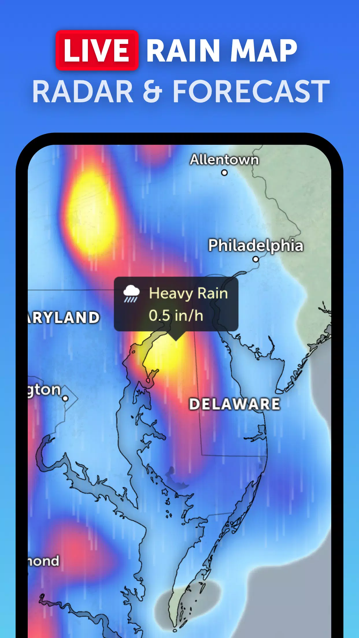
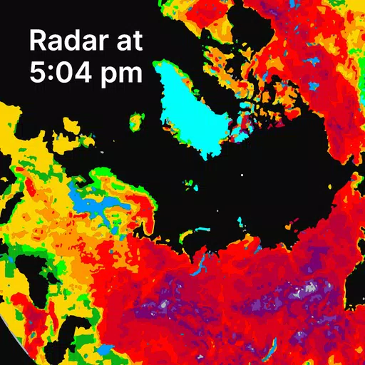
Rain Radar: With Zoom Earth's weather radar map, you can stay ahead of storms by viewing real-time rain and snow data detected by ground-based doppler radar. This feature is invaluable for tracking the movement and intensity of tropical systems.
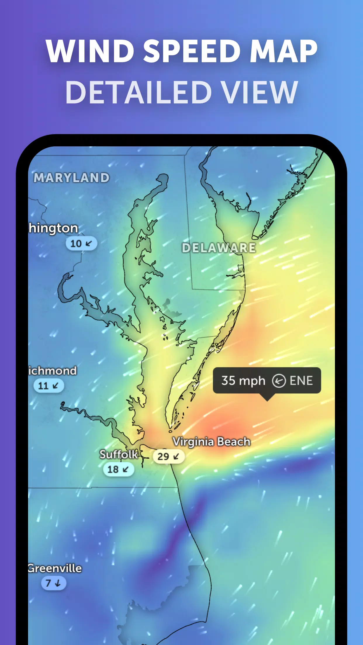
Weather Forecast Maps: Explore visually stunning, interactive global forecast maps that display a range of weather data, including precipitation, wind speed and gusts, temperature, "feels like" temperature, relative humidity, dew point, and atmospheric pressure. These maps provide a comprehensive view of weather conditions, helping users prepare for incoming tropical cyclones.
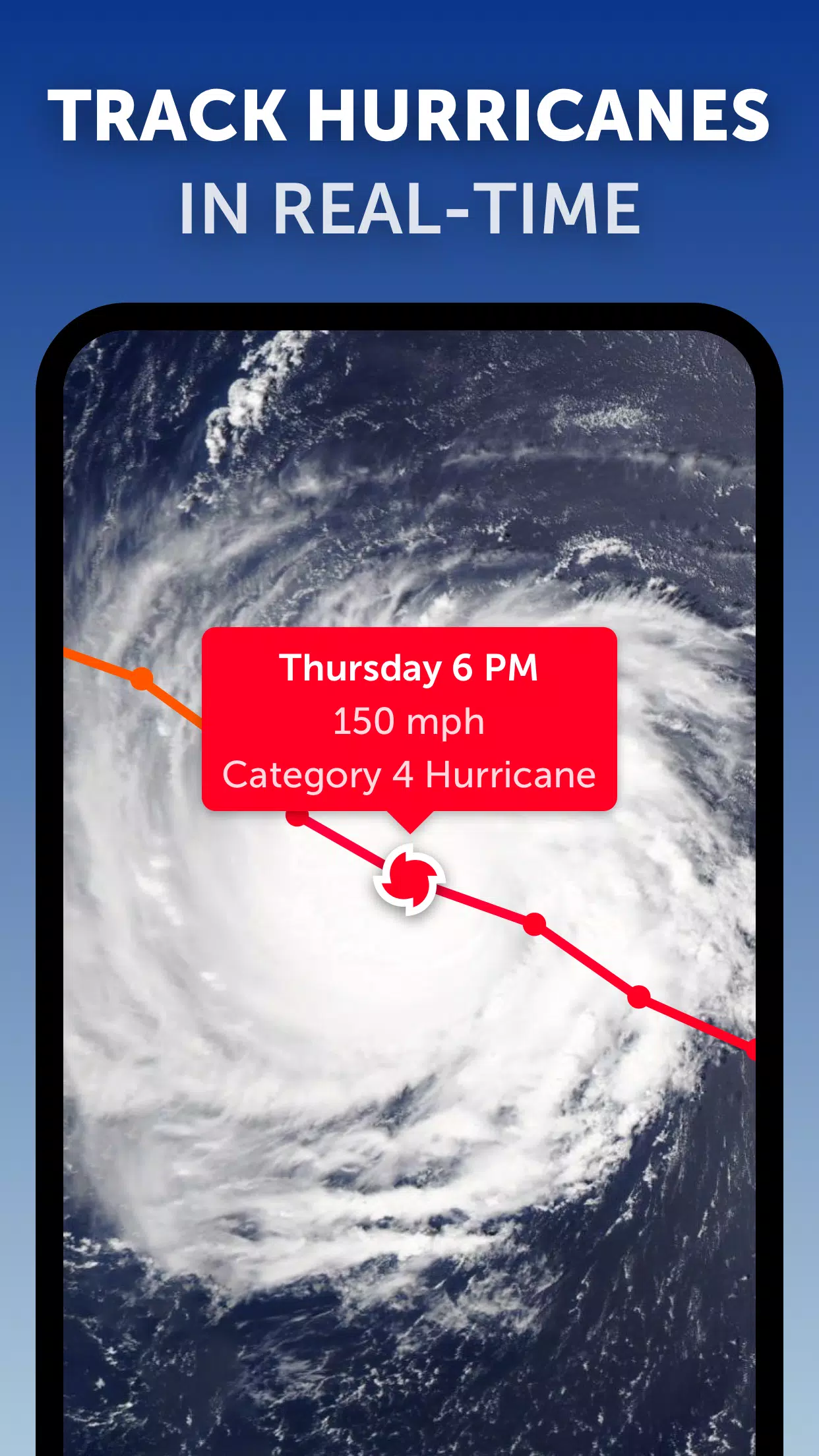
Hurricane Tracking: Zoom Earth's advanced tropical tracking system allows users to follow hurricanes from their inception through to category 5 status in real-time. The platform integrates the latest data from authoritative sources such as the National Hurricane Center (NHC), Joint Typhoon Warning Center (JTWC), Naval Research Laboratory (NRL), and the International Best Track Archive for Climate Stewardship (IBTrACS), ensuring accuracy and reliability.
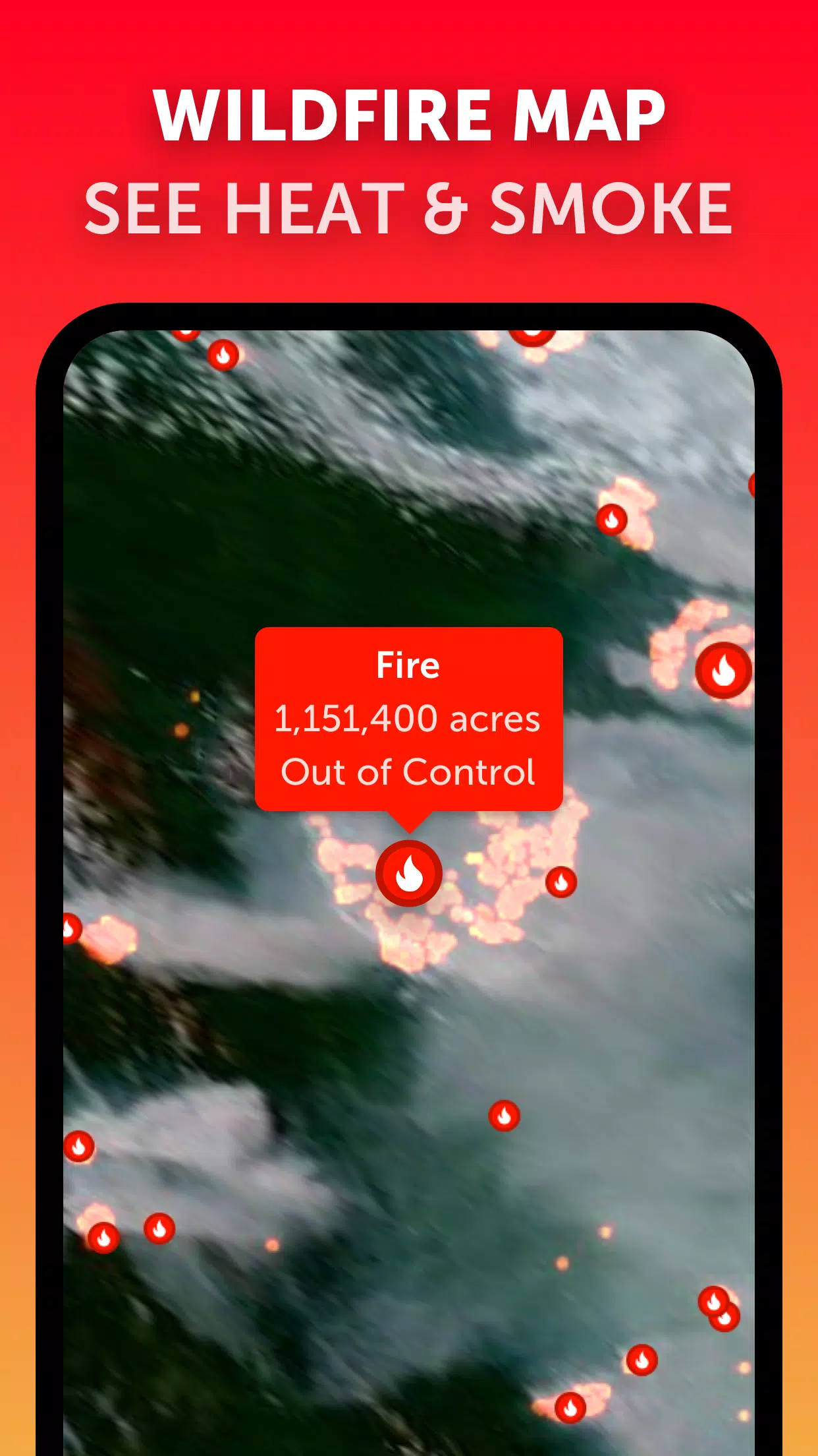
Wildfire Tracking: While not directly related to hurricanes, the active fires and heat spots overlay helps users monitor wildfires. This feature uses daily updated data from NASA's Fire Information for Resource Management System (FIRMS), showing points of high temperature that could impact weather patterns and storm development.
Customization: Users can tailor their experience with Zoom Earth by adjusting settings such as temperature units, wind units, time zone, and animation styles. This flexibility ensures that users can view the data in a way that suits their needs best.
What's New in the Latest Version 3.1
Last updated on Sep 19, 2024
- Reduced clutter when viewing multiple tropical systems, making it easier to focus on specific hurricanes or typhoons.
- Separate alerts for Atlantic and Eastern Pacific systems, allowing for more targeted tracking and notifications.
- Improvements to map labels, enhancing readability and user experience.
With these features and updates, Zoom Earth stands as an essential tool for anyone looking to track hurricanes, typhoons, and tropical cyclones in real-time, providing both accuracy and user-friendly functionality.
Screenshot
Reviews
Apps like Zoom Earth


Trending apps


Top News


Latest Apps


Latest Articles