
Application Description
2GIS is your ultimate navigation and city guide tool, offering an offline map, GPS navigation, live traffic updates, parking information, transit routes, and much more. Whether you're driving, walking, or using public transport, 2GIS ensures you're always on the right path, even without an internet connection.
With 2GIS's detailed maps and navigation, you'll feel at home even in unfamiliar places:
- Easily find addresses, companies, phone numbers, working hours, and details about goods or services.
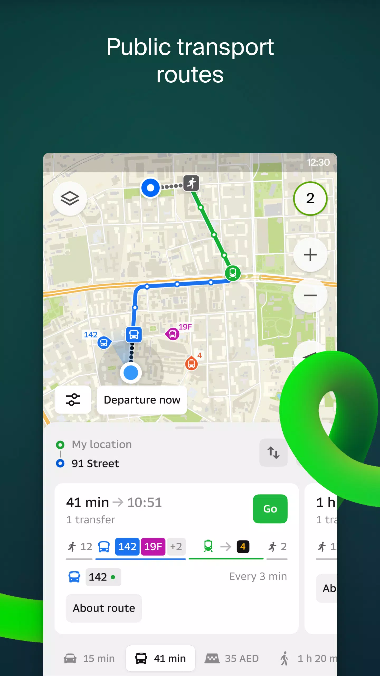
- Discover how to reach your destination by car, bus, subway, or follow pedestrian navigation on foot.
- Locate building entrances and nearby parking lots with ease.
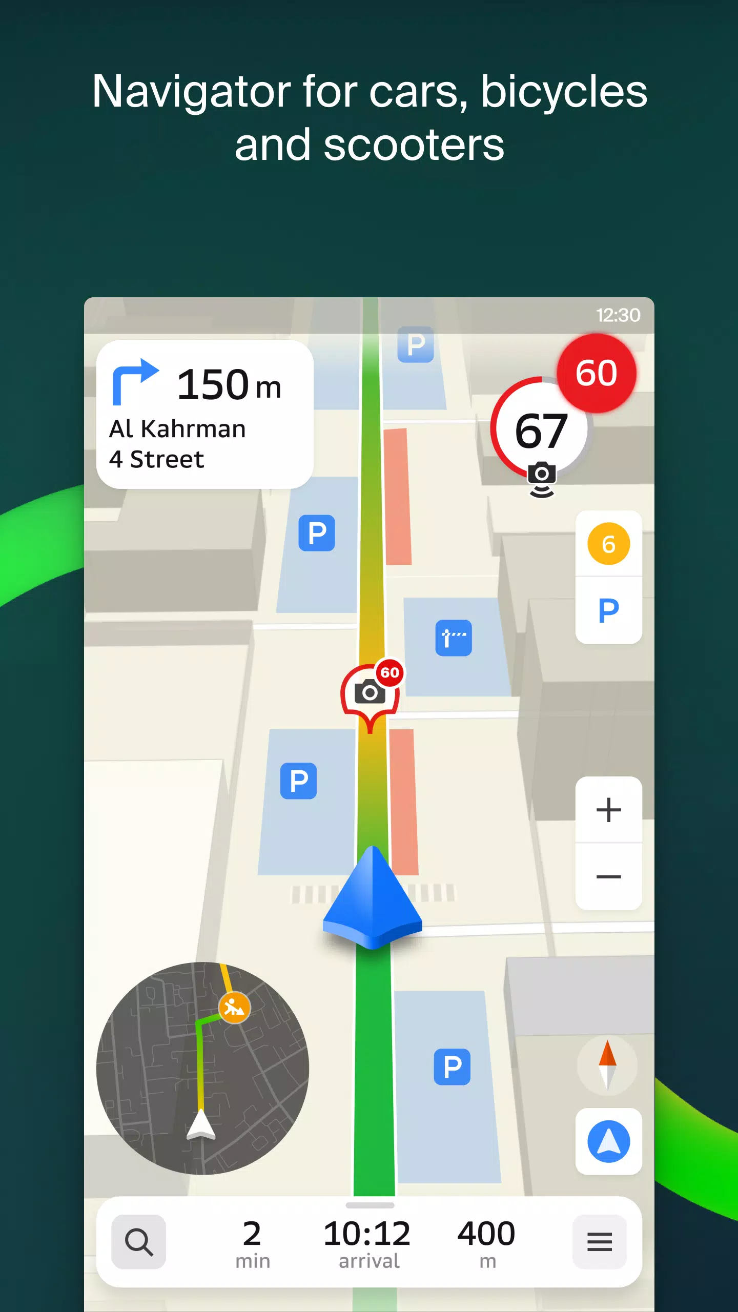
2GIS provides accurate maps that pinpoint districts, buildings, streets, bus stops, subway stations, gas stations, sports grounds, and other significant landmarks.
The GPS navigation feature takes into account real-time traffic conditions, road signs, speed cameras, toll roads, and unpaved routes, crafting the best possible routes between cities and through multiple points. There's also a dedicated app for Android Auto, ensuring seamless navigation in your vehicle.
Stay connected with friends and family through 2GIS's live location feature. Track your kids or friends on the map for safety, share fun stickers, and monitor battery charge levels. You control who can see your location and can adjust your sharing settings anytime.
Stay informed about road events with real-time reports of accidents, blocked streets, and speed cameras, all displayed directly on the map. Additionally, 2GIS offers comprehensive public transport schedules and routes, ensuring you're never late.
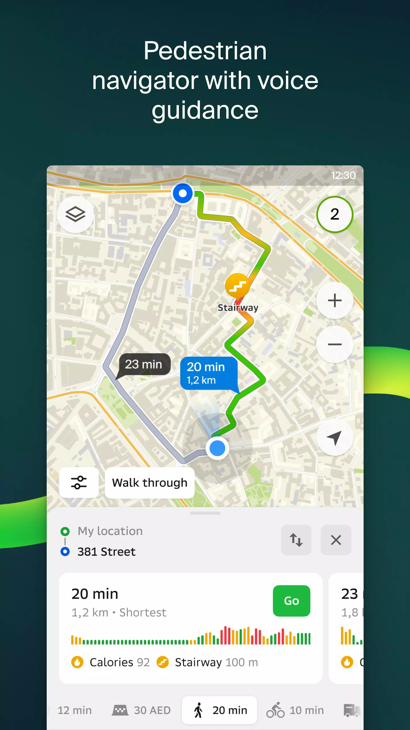
For those on foot, 2GIS's pedestrian navigation guides you to your destination, working in the background with voice guidance for a hassle-free experience. For truck drivers, the cargo navigator provides specialized routes considering the specific needs of your vehicle and cargo.
2GIS also serves as a detailed directory, providing addresses, entrances, postal codes, phone numbers, working hours, social media links, and websites. Users can contribute by adding photos and writing reviews of businesses.
Explore new destinations like a local with 2GIS's travel guide feature, which highlights main attractions and places with Wi-Fi on the map.
For those with smartwatches running Wear OS 3.0 or later, the 2GIS Notifications companion app is a handy navigation tool. It lets you view the map, receive maneuver hints, and get vibration alerts when approaching turns or destination bus stops, all starting automatically when you begin navigation on your phone.
2GIS is available in numerous cities across various countries:
- Cities of the UAE: Dubai, Sharjah, Abu Dhabi, Al Ain, Ajam, Ras Al Khaimah, Fujairah, Umm Al Quwain, Dibba Al Fujairah, Khor Fakkan, Kalba, Al Salamh, etc.
- Cities of Russia: Moscow, Saint Petersburg, Novosibirsk, Ekaterinburg, Krasnoyarsk, Chelyabinsk, Ufa, Omsk, Kazan, Perm, Nizhny Novgorod, Sheregesh, etc.
- Cities of Belarus, Kazakhstan, Uzbekistan, Azerbaijan, and Kyrgyzstan: Minsk, Pavlodar, Semey, Aktau, Aktobe, Almaty, Nur-Sultan, Bishkek, Karaganda, Kokshetau, Kostanay, Osh, Baku, Tashkent, etc.
For any support, you can reach out to [email protected].
Screenshot

Reviews
Apps like 2GIS: Offline map & navigation


Trending apps


Top News


Latest Apps


Latest Articles