
Application Description
City routes, live traffic, transit routes, parking, offline map and navigation.
We are excited to announce that we have updated 2GIS to better showcase the wealth of information we have about cities and companies. The new version of 2GIS features a refreshed design, an enhanced search function, improved city updates, and a seamless integration of favorites with 2gis.ru.
Services, Addresses, and Companies
2GIS is your go-to source for finding out which service provider operates in your building, locating your nearest district hospital or post office, and choosing the perfect cafe or service center based on reviews and photos. We provide detailed information including opening hours and contact numbers.
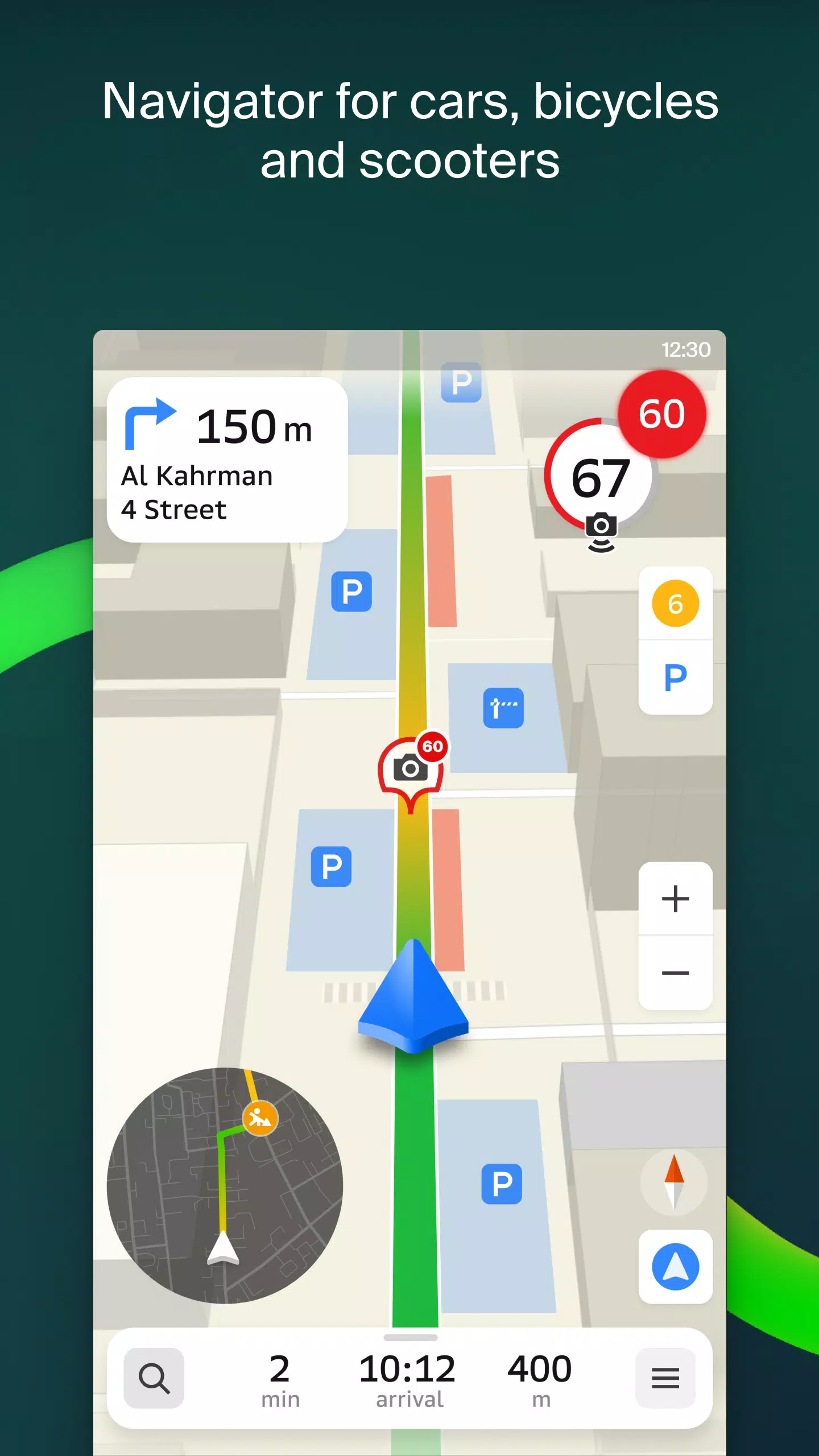
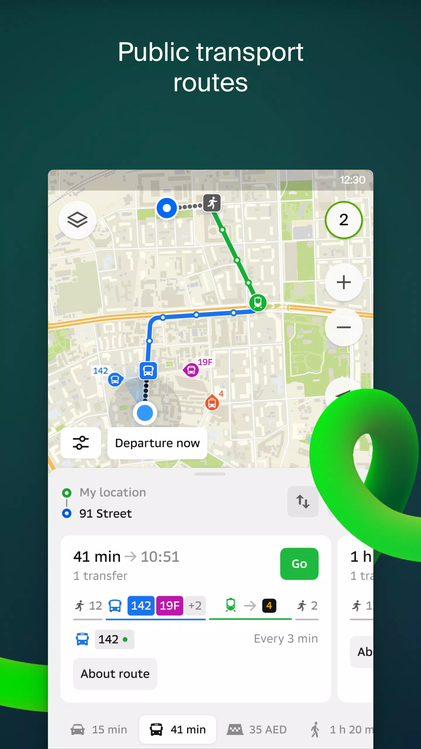
Transport and Navigation
For drivers, 2GIS offers real-time navigation with voice instructions, taking into account traffic conditions and road closures. If you stray from your planned route, we'll recalculate it instantly. For pedestrians, we provide options for traveling by bus, metro, train, cable car, and even river tram.
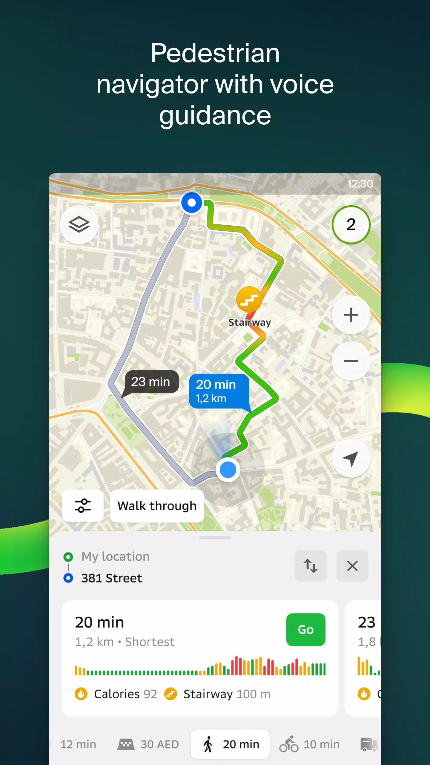
Walking Routes
Our pedestrian navigation system guides you on foot, working seamlessly in the background with voice guidance to ensure you reach your destination effortlessly.
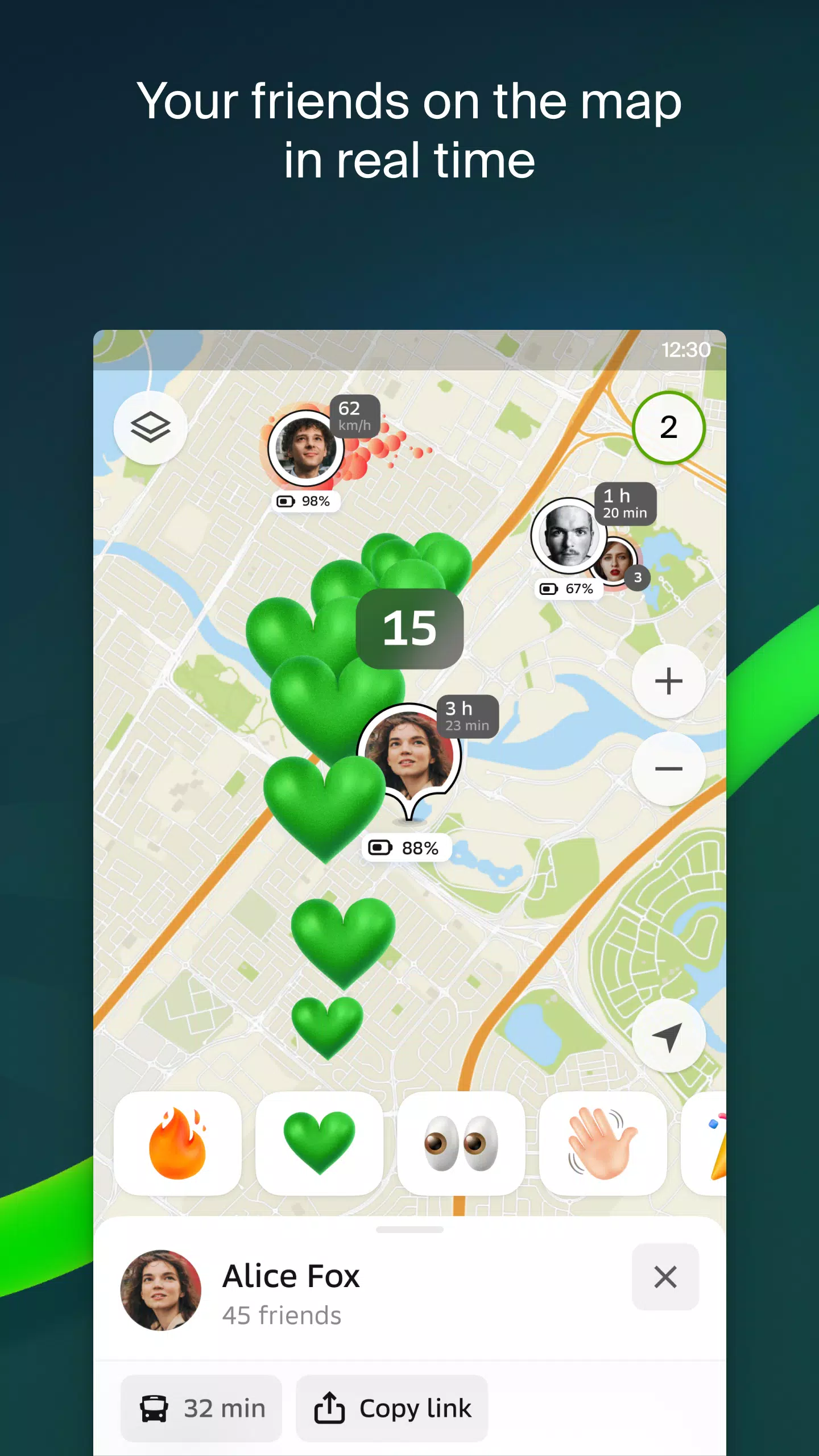
Friends on the Map
With 2GIS, you can now track the real-time location of your friends and family on the map. You have full control over who can see your location and who you can see, all manageable through our settings.
Building Entrances
No more wandering around to find the right entrance to a business center. 2GIS provides detailed entrance information for over 2.5 million companies, guiding you right to the door, whether you're arriving by public transport or car.
Plans of Shopping Centers
Navigate shopping centers with ease using 2GIS. We map out everything from shops and cafes to ATMs and restrooms, helping you plan your visit in advance to save time.
2GIS Beta Notifications Companion App for Smart Watches
Our new beta companion app for Wear OS smart watches enhances your navigation experience. It supports walking, biking, and public transport routes directly from the main 2GIS beta app, offering map views, maneuver hints, and vibration alerts as you approach turns or bus stops. The app starts automatically when you begin navigation on your phone and is compatible with Wear OS 3.0 and later.
By using the beta version, you'll receive the latest updates as we fix bugs and improve features, contributing to the development of a new version that will be used by millions. You can run both the original and beta versions simultaneously and switch between them at any time.
Support: [email protected]
What's New in the Latest Version 6.44.1.559.3
Last updated on Oct 19, 2024
We're thrilled to bring you these beautiful, crisp updates:
- We now display wide, realistic roads on the main map and when searching for routes.
- Introducing much-anticipated Chats for Friends! Message each other without leaving the map.
- Added notifications when a friend is nearby (can be turned off in settings).
- Just in time for ski season: we've added ski lift statuses on slopes: see whether they're open or not.
- If your public transport route includes walking, we’ll calculate the walking part in steps.
Screenshot
Reviews
The live traffic updates are a lifesaver! 🚗 Makes my daily commute so much smoother. Search function could be faster though. -Alex
Apps like 2GIS beta


Trending apps


Top News


Latest Apps


Latest Articles